
Mike heading out from Tsusiat Falls on our fourth day
Mike, Dom and myself arrived at the Bamfield Ranger station for our trail orientation, thoroughly awakened after a long bumpy, bone jarring bus ride along endless logging roads from Port Renfrew. My Uncle being the "brains" of the trek soaked up the orientation and asked detailed questions concerning tides that would affect our hike. A continued theme throughout the adventure. Dom and I being the "muscles" looked eagerly over the free map Parks Canada provides. Reading the intimidating quotes like "100 injured hikers are evacuated every season" and "tsunamis rare but dangerous" only got our hearts beating a little faster and made our time of departure even far away!
We departed the outrageously priced Pachena Bay campground the following morning and our West Coast experience got off to a quick start with this lovely sign.

We're a stubborn bunch. So we took the ladders any way!

The first of a "bajillion" ladders
About 17km later we arrived at Tscowis creek where we decided to make camp and enjoy its lovely water fall and some prime real estate. It seemed that most of the northbound hikers camped at Michigan or Darling creek to make their last day shorter which must finish at 1pm to catch the bus back to Port Renfrew.

Yep! there is the lovely water fall

"prime real estate" means a convenient table and chairs! what more could you want!

A backpacking trip isn't complete without some pancakes!
Day 2 we headed out early to get a prime campsite at Tsusiat falls our next campsite, northbound hikers passing us on our way south had great things to say about the falls. Indeed it was quite nice with a big water fall and an opportunity to cool off! The trail this day was a bit of woods, and a bit of beach with a long cable car crossing across the Klanawa river.

I had to make sure it was real....

Son and Father team pulling up to the docking station

Along the trail

The falls in all their glory!
A highlight of day 3 included a fresh feast of fresh crab! yea check it out at the Nitinat Narrows crossing about 33km from the trail head and look for Leon Edgar our chef and ferry captain. A nice respite from slippery boardwalks, "perma-mud" bogs, and soft sandy beaches. Later that day some shenanigans at Cribs creek camp entertained us until a stunning sunset gave away to some spectacular stars.

Joy.

Cheewat river bridge a mandatory picture

Shenanigans!

Amazing sunset!!!!
From Cribs creek on Day 4 we hiked to Walbran Creek another must visit campsite! A fairly uneventful 10km full of the trails scenic views and a majestic light house and don't forget a visit to Chez Moniques little bbq to get your $20 "fully loaded" burger!

Chez Moniques
Beachwhacking

Carmanah Lighthouse
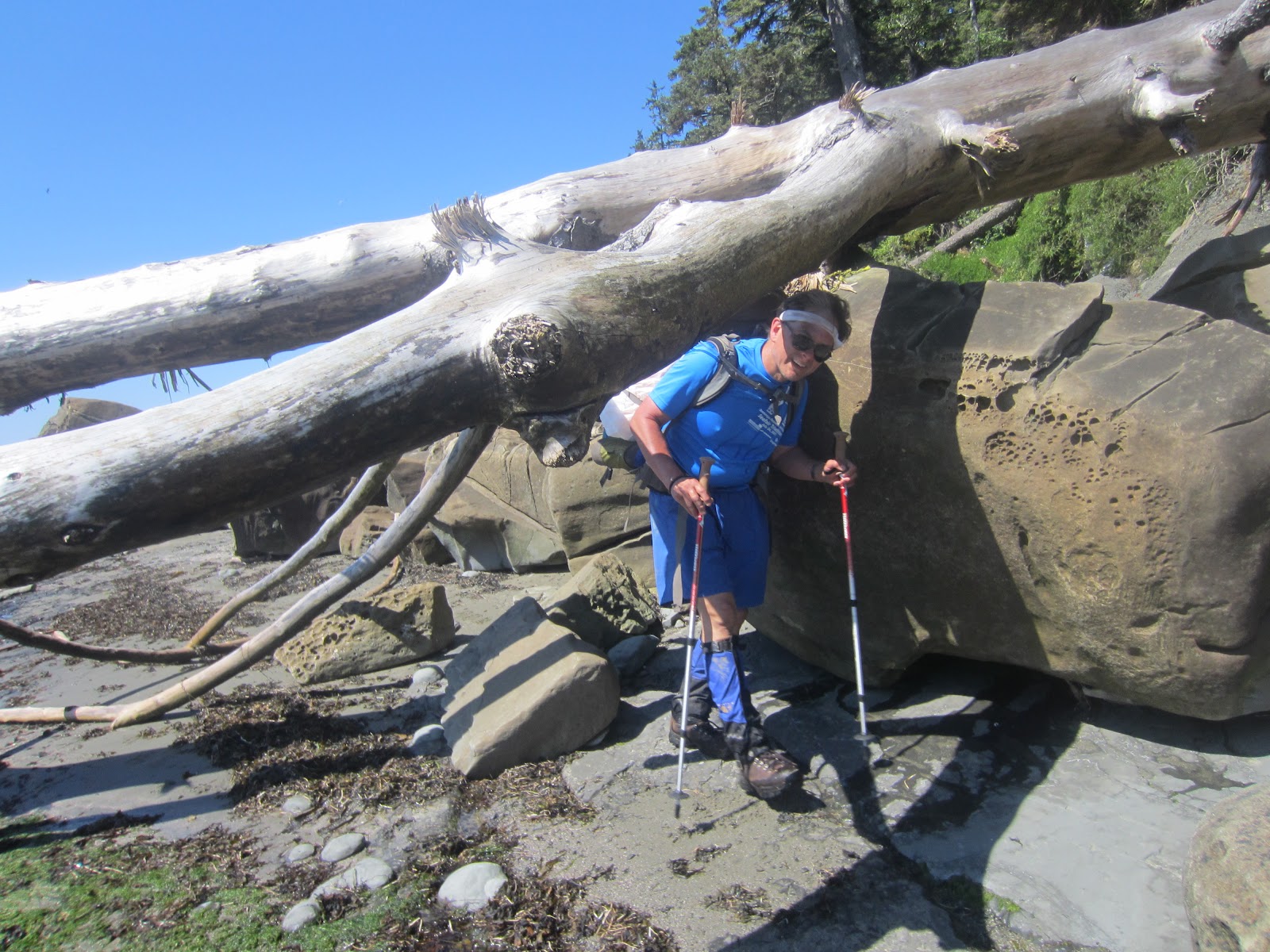
From Walbran the trail becomes ridiculous. This is where it earns the reputation as being one of the roughest trails in North America. Roots, mud, fallen trees and rotten boardwalks plus dense vegetation come together in an effort to mentally, emotionally and physically destroy the cheerful hiker. Honestly its bad, carry a light pack, bring trekking poles and get an early start, I've been hiking and climbing for years and found this stretch to be fairly debilitating. We ended the day at Camper bay exhausted and ready for some relaxation.

Head band time!!!

Bridge across Logan Creek!

Ladders....endless ladders!!!

Apparently we weren't alone in our misery

Over or under?

ARRGGHHH!
Our last day we departed Camper bay at the absurd hour of 5am so Dom and I could squeeze around Owens Point before an early high tide closed off the wondrous sea caves of this stretch. Our first 3km we hiked on the same miserable trail in the DARK! (I don't recommend this!) At sunrise we arrived on the beach described as a moonscape by guide books dodging over surge channels and some spots so slippery we hilariously slipped across. The sea caves at Owens point truly lived up to their surreal reputation and provoked some thoughts about the power of the ocean and tide. The point to Thrashers cove and out to Gordon river passed by without event, only a few good wipeouts on roots or boulders.

Heading towards Owens Point

Moooooonscape!!!

First of the big caves too bad we couldn't explore this one!

Can't jump this surge channel!!!

Dom first!!!
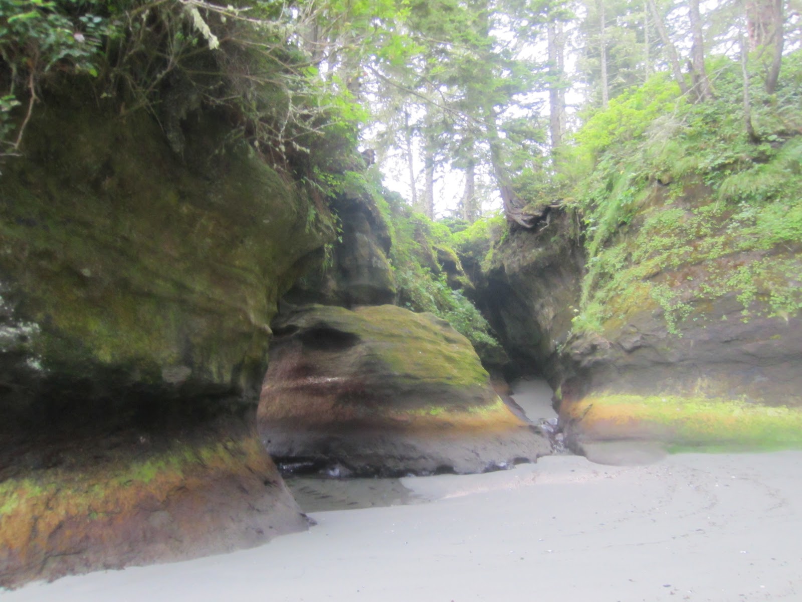
Behind the sea caves at Owens Point

Another shot looking out of the cave

Come at me bro!!!

Yay!!!!! we made it!! last ferry crossing on the Gordon River